Ancient Bristlecone Forest

EppsDynasty

Well-Known Member
Platinum Tortoise Club
Joined
Oct 4, 2022
Messages
896
Location (City and/or State)
Canebrake Ca
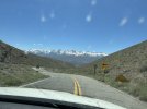
Another day trip! On our way to Ancient Bristlecone Forest.IMG_1278.jpeg
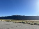
This area is known as Fossil Falls. It is full of lava rock just like you would see in a bbq or your flower bed. In the picture, the power lines are at least 60 feet tall. That would make this shear cliff at least 100 feet tall of ancient lava.IMG_1280.jpegIMG_1281.jpeg
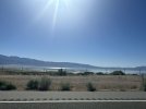
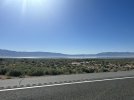
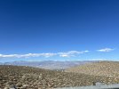
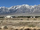
This picture is from the northern edge of Owen’s lake. This past winter when California had extensive rain storms flooding the state, they had the opportunity to allow the lake to fill up a couple of inches. This would have allowed them to control the dust on the ancient lake bed naturally. Instead, they sucked every bit of water they could out of the lake. This forces them to use sprinklers now to control the dust, which run off electricity.
 

EppsDynasty

Well-Known Member
Platinum Tortoise Club
Joined
Oct 4, 2022
Messages
896
Location (City and/or State)
Canebrake Ca
IMG_9507.jpeg
This is a photo of Manzanar. Yes, the internment camp. This is one of the sights that the Japanese were kept during WW2 after the bombing of Pearl Harbor. Our family has visited this preserved site many times. It has incredible history… a must see.
 

wellington

Well-Known Member
Moderator
10 Year Member!
Tortoise Club
Joined
Sep 6, 2011
Messages
50,213
Location (City and/or State)
Chicago, Illinois, USA
Another day trip! On our way to Ancient Bristlecone Forest.View attachment 370532
This area is known as Fossil Falls. It is full of lava rock just like you would see in a bbq or your flower bed. In the picture, the power lines are at least 60 feet tall. That would make this shear cliff at least 100 feet tall of ancient lava.View attachment 370533View attachment 370534
This picture is from the northern edge of Owen’s lake. This past winter when California had extensive rain storms flooding the state, they had the opportunity to allow the lake to fill up a couple of inches. This would have allowed them to control the dust on the ancient lake bed naturally. Instead, they sucked every bit of water they could out of the lake. This forces them to use sprinklers now to control the dust, which run off electricity.
Figures!
 

TammyJ

Well-Known Member
5 Year Member
Joined
Jun 21, 2016
Messages
7,388
Location (City and/or State)
Jamaica
What about some more pictures? I love to see big open landscapes. Nothing like that here where I live!
 

EppsDynasty

Well-Known Member
Platinum Tortoise Club
Joined
Oct 4, 2022
Messages
896
Location (City and/or State)
Canebrake Ca
@TammyJ ....I LOVE IT.... reading your last post almost woke the family with my hysterical laughter. We made it home safe. I am working on posting all the photos, what happens is we get off into the wild unknown and lose cell service. Then when we do get back to cell service it's far to hard to see the pics on the phone and know what to post, so I end up having to wait till I get home to view em all.
 

EppsDynasty

Well-Known Member
Platinum Tortoise Club
Joined
Oct 4, 2022
Messages
896
Location (City and/or State)
Canebrake Ca
So here we go……..

IMG_1292.jpeg
I saw this and immediately thought of my dear friend that lives right by this highway ... just a hundred miles over the Sierra Nevada Mountain Range. @Yvonne G it is you.

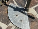
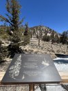
You'll get a better feel for it in just a bit but had to point this out, its a pipe that you look through and on the base is a pointer that "Points" to the mountain peak you are looking at through the pipe. Mt Dana.IMG_1304.jpeg
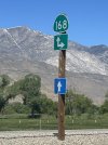
Now up the hill headed to the ancient forest, in less than 23 miles we went from a few hundred feet above sea level to over 10,000 feet above ... I was driving too, sooooo much fun.IMG_1310.jpegIMG_1311.jpegIMG_1312.jpegIMG_1313.jpeg
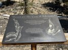
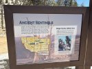
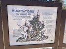
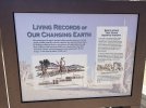
This by FAR was my favorite sign. I couldn't help but think of the 2 little guys we just took in 2 days ago. Adversity and survival ...Damn they must of suffered. At this point I'm already missing my animalsIMG_1314.jpegIMG_1316.jpeg
IMG_1317.jpegIMG_1318.jpeg
IMG_1320.jpeg
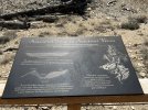
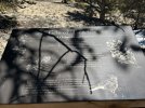
I took this picture so you could see "The Trees." So crazy to think in this big world right here on this little slope are trees that have been here for so long. Could you imagine riding on horse back 150 years ago and coming across these trees? IMG_1321.jpegIMG_1325.jpeg
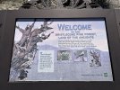
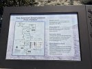
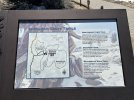
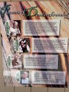
I really hope you all can zoom in and read these signs... if not just follow along.
 

Yvonne G

Old Timer
TFO Admin
10 Year Member!
Platinum Tortoise Club
Joined
Jan 23, 2008
Messages
93,418
Location (City and/or State)
Clovis, CA
@TammyJ ....I LOVE IT.... reading your last post almost woke the family with my hysterical laughter. We made it home safe. I am working on posting all the photos, what happens is we get off into the wild unknown and lose cell service. Then when we do get back to cell service it's far to hard to see the pics on the phone and know what to post, so I end up having to wait till I get home to view em all.
Yeah, but how about stopping to let Tammy pee?
 

EppsDynasty

Well-Known Member
Platinum Tortoise Club
Joined
Oct 4, 2022
Messages
896
Location (City and/or State)
Canebrake Ca
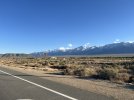
Next ..... Here is a video from above 10,000 feet looking across the valley (commonly called the 395 corridor) at the Sierra Nevada Mountains. The video starts looking North at Mammoth Lakes area and panns left across the peaks of the Mt. range, the video ends looking at the North end of Death Valley....hey thats where we were just yesterday. This was one of the most incredible views we have ever seen. None of the Epps family knew how the tops of the mountains we drive by looking up at were, it was a spectacular surprise to see that they were not shear cliffs as we see but instead the mts. were almost a flat surface with peaks spotted throughout.
We then tried to go even higher up the Ancient Pine Forest road ....UhhhhIMG_1326.jpeg
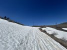
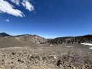
This is what we ran into, that is the road...You'll notice our son walking in the back of the shot, end of the line. This was such a shock, sooooo much snow still. In the next pic I tried to show what the landscape looked like where the sun shines, not a lot of snow but instead it was like a Desert at 10,500 feet.IMG_1327.jpeg
This video is of the drive down or at least the start of it.
So you'll see in the next pics we are headed to those mountains to find new things. It was incredible.IMG_1334.jpeg
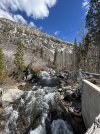
So we went down then back up the other side headed up above Bishop CA for the first time, no telling what we'll find. This next pic is a High Sierra stream soooo cold.IMG_1345.jpeg
We reached Lake Sabrina ....WOW this was a sight. An absolute High Sierra Lake full of Trout. If you google Lake Sabrina you can see pics of it when it has water in it, or at least more water. There is a person on the right for scale.IMG_1361.jpeg
Here is a pic of water just coming out of the mt with no creek or river anywhere around, so damn coolIMG_1386.jpeg
We took some photos and headed out having NO IDEA what we were about to see, it blew us all awayIMG_1387.jpeg
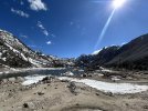
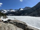
Holy S%I$ .... A frozen lake...The whole thing frozen....in the middle of May. Our family found this absolutely Beautiful and way unexpected. I found a fishing lure wrapped in a tree as a souvenir, It will help me remember this CRAZY site. This lake is South Lake. We left here and headed back down the mountain to the valley....Bishop CA.IMG_1404.jpeg
Those mountains across the pic are the Ancient Bristlecone Forest we were just at a few hours earlier. This was so cool to see where we were earlier in the day but looking from 10,000 feet across ...WOW.
What a full day and full of new things and new memories. On the way home we drive through Independence CA a treasure to the Epps Family. This is named after Fort Independence from the cowboy and Indian days. We come to this town to watch 4th of July fireworks. I don't think it gets much better than sitting at Fort Independence watching a celebration of our country through explosions, about as patriotic as it gets. IMG_1409.jpeg
That is the Sierras on the right of the pic. Not too far down the road and we're passing Manzanar again, look closely and you'll see the watchtower. The Mountain to the left (little one) is Alabama hills, you'll have to look closely but you may see John Wayne on his horse. IMG_1413.jpeg
If you have made it this far Thank You for sharing this with us. I truly see the TFO as our family and wish we all could be here in person TOGETHER.
 

Yvonne G

Old Timer
TFO Admin
10 Year Member!
Platinum Tortoise Club
Joined
Jan 23, 2008
Messages
93,418
Location (City and/or State)
Clovis, CA
I didn't know this place (the bristle cone pines place) existed. Thanks for sharing.
 
Last edited:

TammyJ

Well-Known Member
5 Year Member
Joined
Jun 21, 2016
Messages
7,388
Location (City and/or State)
Jamaica
After all this...I am speechless with awe and gratitude! Absolutely amazing. I am brought to tears of longing, truly. You would have a heart attack if you saw a desert tortoise? I would already have died of joy just from being where I might see one!!! Thank you so much.
 

EppsDynasty

Well-Known Member
Platinum Tortoise Club
Joined
Oct 4, 2022
Messages
896
Location (City and/or State)
Canebrake Ca
After all this...I am speechless with awe and gratitude! Absolutely amazing. I am brought to tears of longing, truly. You would have a heart attack if you saw a desert tortoise? I would already have died of joy just from being where I might see one!!! Thank you so much.
It makes me feel good you enjoyed it. Thank you. It would be hard to imagine my life without you all in it, however it is ... via internet.
 

Tom

The Dog Trainer
10 Year Member!
Platinum Tortoise Club
Joined
Jan 9, 2010
Messages
63,629
Location (City and/or State)
Southern California
This picture is from the northern edge of Owen’s lake. This past winter when California had extensive rain storms flooding the state, they had the opportunity to allow the lake to fill up a couple of inches...
You noticed that too, huh?
 
Top